Short Pump's Outdoor Museum

How Henrico County turned three failing park walls into 400 years of history you can walk through.
What happened here, in plain language.
Short Pump Park had three curved concrete walls with nothing meaningful on them. The county had tried before: a dimensional signage system meant to tell local history. It failed. The letters buckled, water got in, and children started climbing the raised elements until minor falls forced Henrico Parks to tape off the area entirely.
Henrico County approached Untitled Mixed Media directly. What followed was nearly two years of preparation: gathering archival images from historical societies, private family albums, and library collections, then securing the funding and approvals needed to commission a permanent outdoor museum. When the research was complete and the contracts were signed, the installation itself took another three months, with Virginia summer heat and weather conditions driving the pace of the work.
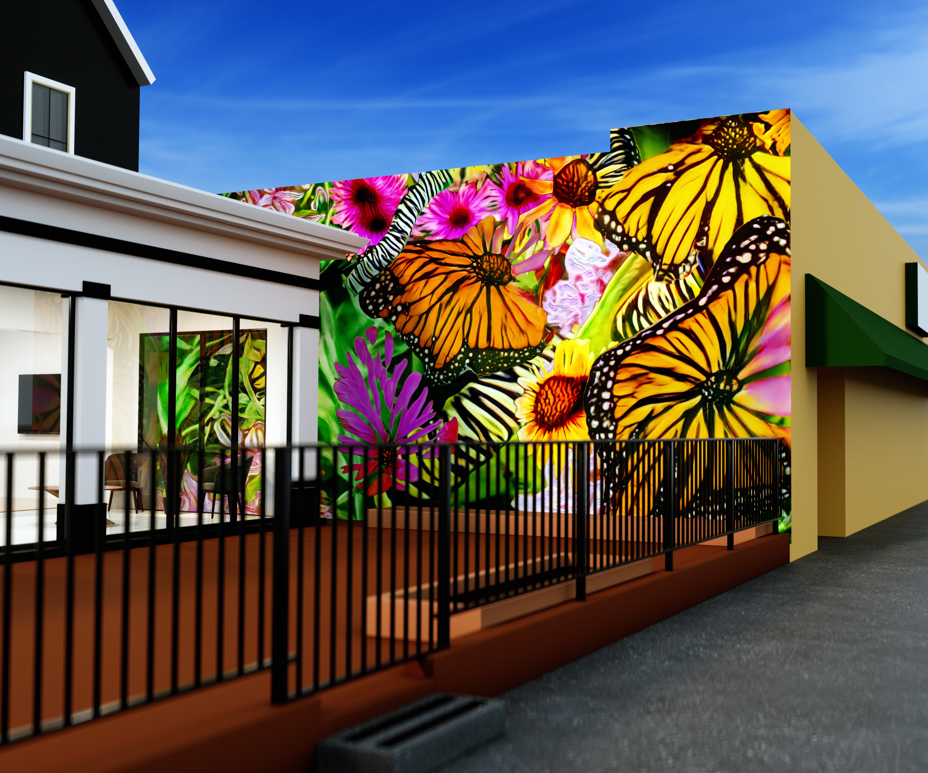
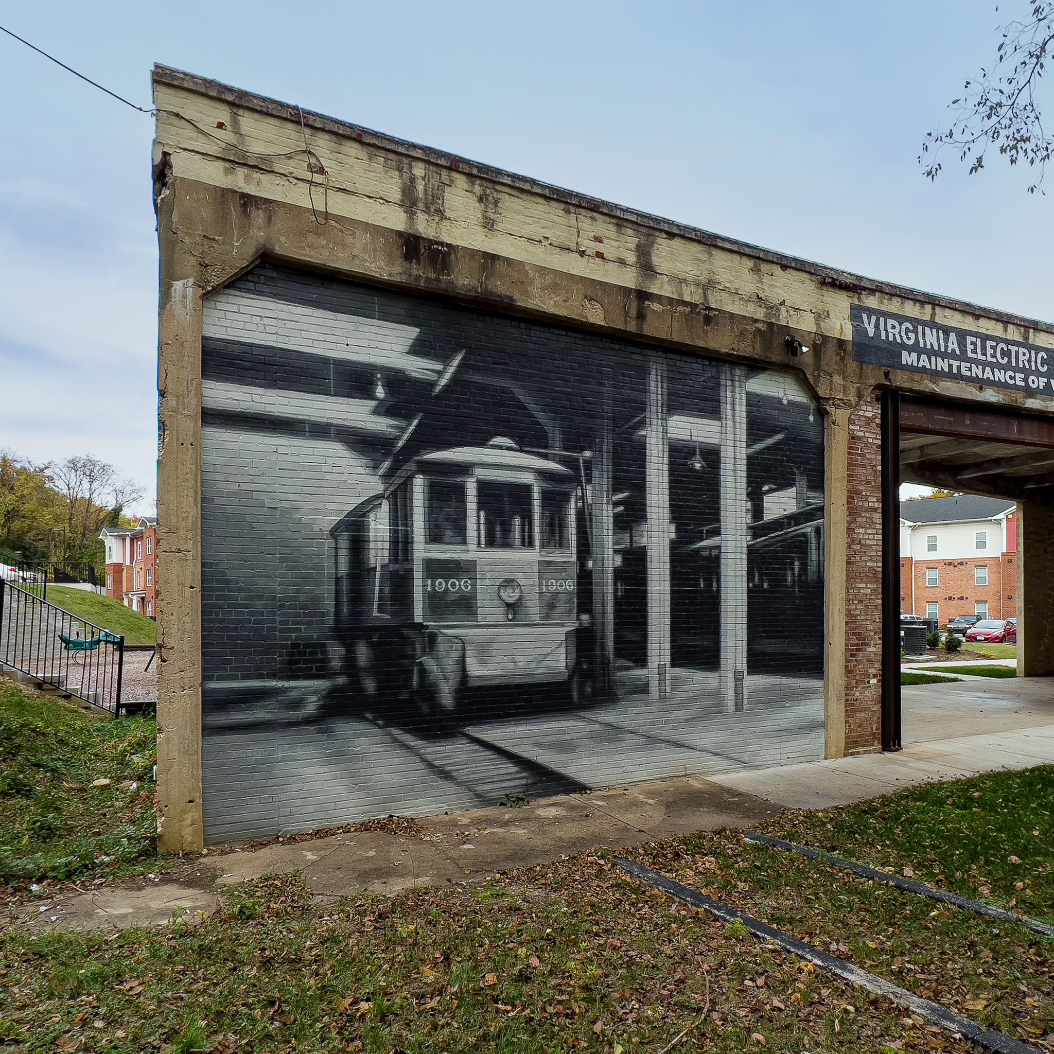
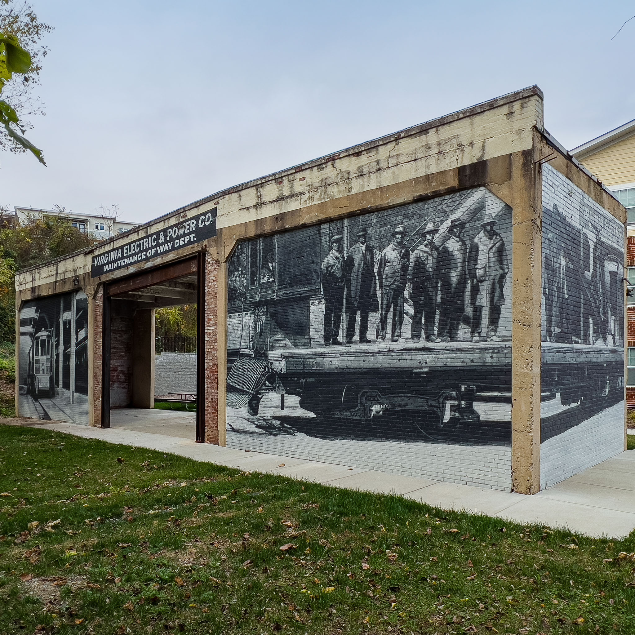
The result is an outdoor museum. Three walls, each fully wrapped on both faces, carry three chapters of Short Pump’s history in black and white. A 30-by-10-foot ground map, painted in a specialized paint system that can take bus traffic and still hold its surface, ties the installation into the geography underfoot.
The walls and the ground now tell the same story. You don’t read Short Pump’s history here. You stand inside it.
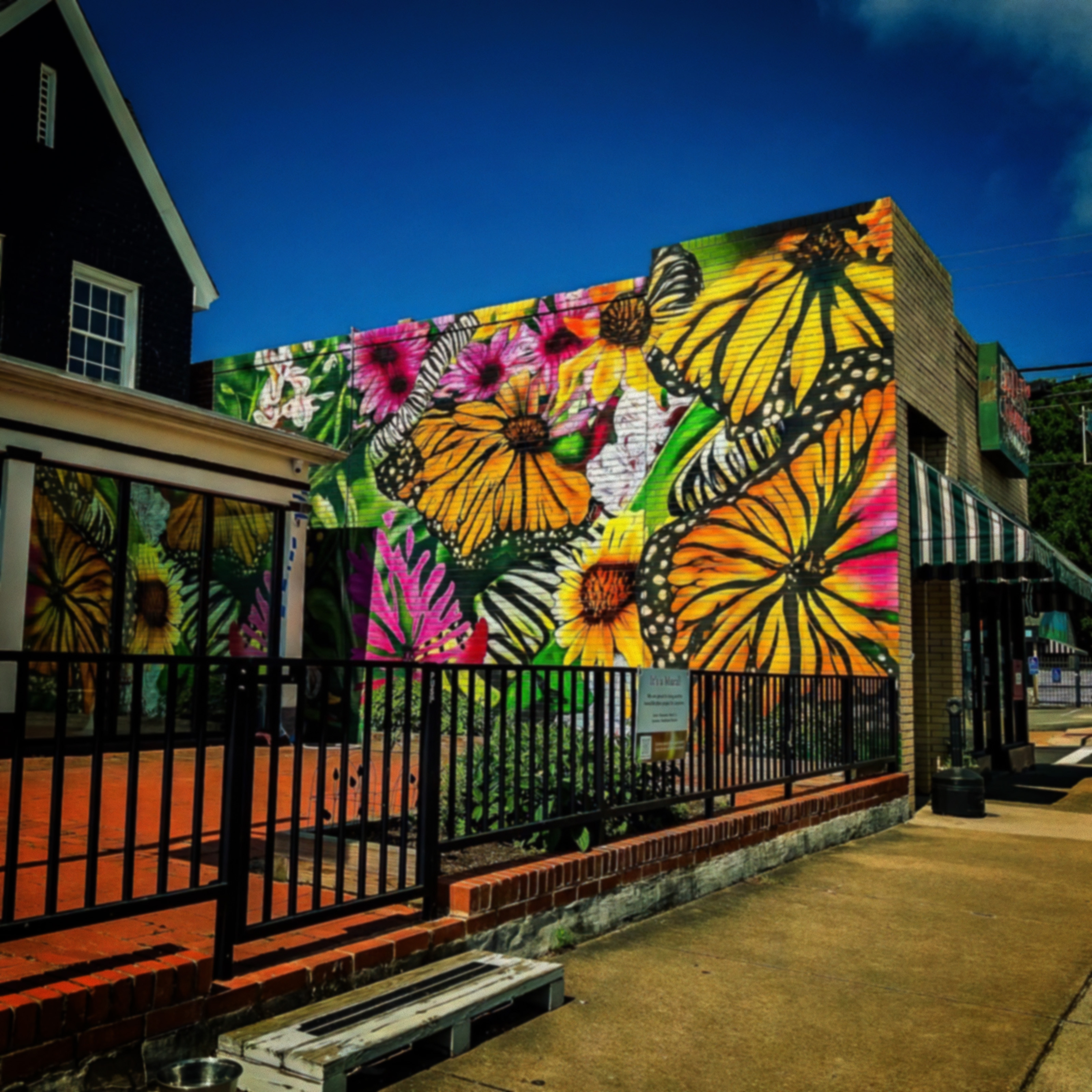
The walls were a problem before they were a canvas.
Short Pump Park sits a short walk from Short Pump Town Center, surrounded by chain restaurants, apartment buildings, and the kind of commercial development that turns every intersection into something that could be anywhere. The park is the gap in that pattern: 45 acres of grass and wooded trails, a splash pad, one of only two off-leash dog parks in the entire Henrico County system, and three freestanding curved concrete walls that had been meant for something and ended up being nothing.
The original Short Pump History Wall was an honest attempt. Dimensional routed-foam letters were mounted to the wall surfaces to tell local history. Within months, adhesive and fixtures couldn’t hold. The letters buckled and loosened under weathering. Children discovered that protruding elements made excellent footholds. After two minor falls, the county taped off the area and issued an RFP with a clear mandate: make it safe, make it last, make it mean something.
The county wasn’t just asking for a mural. They were asking for something to replace a thing that had already failed, in a neighborhood where the actual history was disappearing faster than anyone was preserving it. The old general store at the crossroads came down in 1996 for a road-widening project. The mall opened in 2003. Short Pump’s population grew nearly 24 percent in a single decade. They needed work that would earn long-term trust.
That’s a harder request than it sounds. It requires a fundamentally different process than most mural projects.
Four hundred years of history beneath your feet.
Short Pump isn’t just a suburb that happened to a rural area. It’s a place with a specific, documentable past that most of the people living there today have never encountered.
Three Chopt Road, which runs past the park, began as a Native American trail marked by three notches carved into trees at intervals along the path. The Short Pump Tavern opened around 1815, took its name from the short-handled pump beneath its porch, and became a stagecoach stop on the principal route between Richmond and Charlottesville. The Nuckols family farmed the surrounding land for six generations. Gayton Mines operated less than a mile from the park site and was one of America’s first commercial coalfields. Children once rode a mule-drawn covered wagon along Pump Road to reach the consolidated school that opened in 1911.
That last building still stands inside the park. The Deep Run School, built in 1902 for $700, was relocated here in 1996 and now operates as a free museum open on weekends. It sits inside one of the county’s most heavily visited parks, passed daily by dog walkers, families at the splash pad, and youth athletes on the fields. Most of them have no idea it’s there.
Native American people lived on this land long before the colonial period, before the tavern, before the road, before any of the names now attached to this place.
That’s the history that sits under Short Pump Park. Most of the county’s current residents have no idea it exists. Most of its current children will grow up and leave without knowing their neighborhood has a story.
That’s the cost of an empty wall. It’s not just aesthetic. It’s generational.
Research: Fifty archival photographs and ten conversations.
We started three weeks before a brush touched anything.
Working with primary sources from the Short Pump Historical Association, the Library of Virginia, and private family albums, we collected 50 to 75 archival photographs documenting the area’s evolution. We also interviewed ten residents whose ages ranged from nine to 87. From those conversations, a single organizing thread emerged: “Everything starts and ends on Three Chopt Road.”
That road, its intersections, the buildings lining it, and the people who traveled it became the spine of the entire installation. One detail from that research captures the scale of what’s been lost: the Nuckols family farmed this land for six generations. What was once their driveway is now Cox Road.
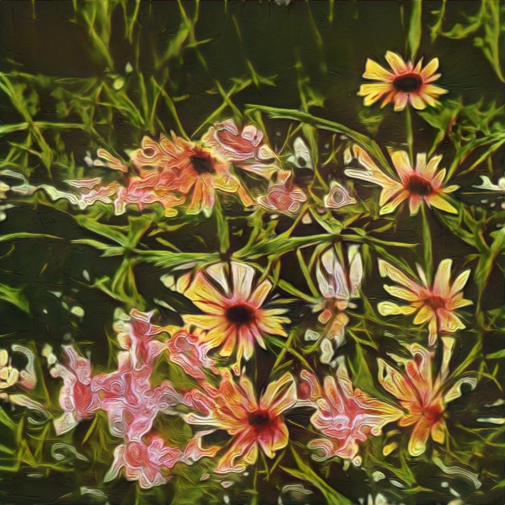
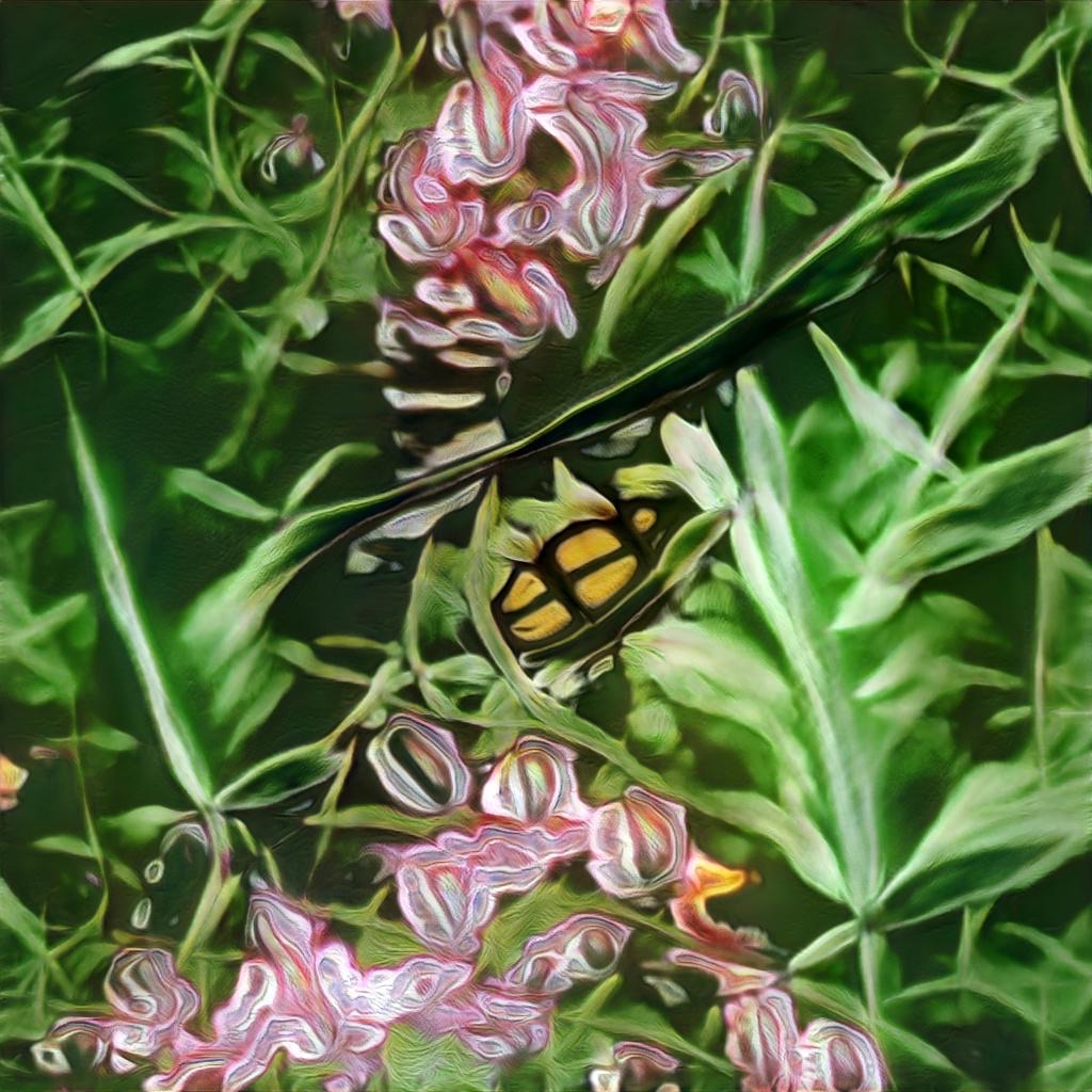
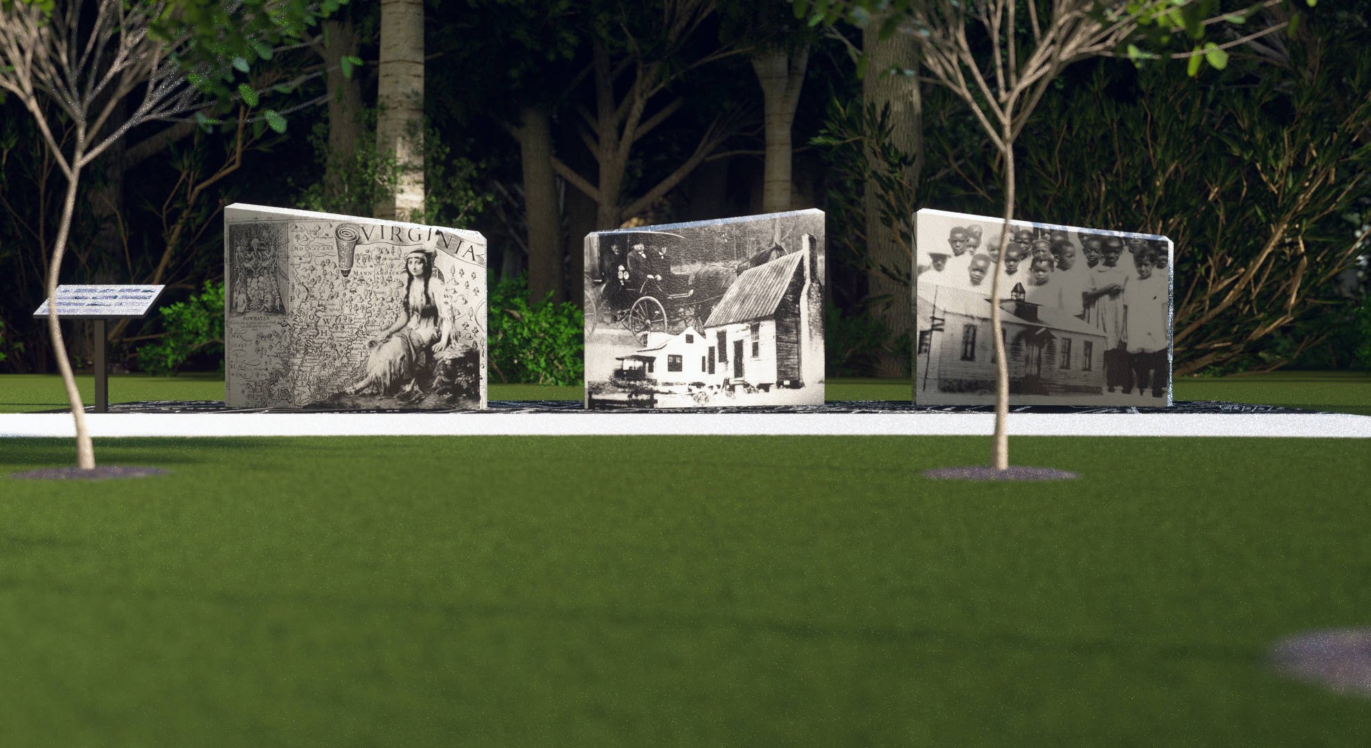
The three curved walls suggested a natural three-chapter structure. The first chapter would cover Native American heritage: the way this land was understood and used before European contact. The second would cover industrial and agricultural growth: the coal mines, the farms, the tavern, the general store, the commerce that built the county. The third would cover education: the schools that shaped the community’s future and the unequal history of who had access to them.
A vintage territorial map of Henrico County provided the unifying element. Black background, white line-work, property owners’ names, the roads as they actually ran in an earlier era. Reproduced at 30 feet across on the ground below and between the walls, the map would physically place visitors inside the geography they were reading about. A small “You Are Here” marker would locate them precisely within Short Pump’s documented history.
The conceptual anchor came from a site visit during week four. The walls align with the cardinal axes of the historic stagecoach lines through this area. These aren’t murals on walls. They’re longitude markers for memory.
The hardest work nobody sees: getting the walls ready.
Before any painting could begin, the walls themselves had to be rebuilt. Virginia’s summer heat made it harder. Direct sun on concrete walls in the humid mid-Atlantic raises surface temperatures well beyond air temperature, shortening working windows and slowing the cure on each coat. Weather delays pushed the installation timeline. The project ran three months from first prep to final protective coat.
The synthetic concrete surfaces were severely pitted, water-stained, and cracked throughout. The old dimensional signage had been mounted with hardware that left behind holes, surface damage, and inconsistencies across all three wall faces. Getting from that condition to a stable, archival-quality substrate required removing what remained of the old installation, repairing every crack and penetration, and applying a quartz-fortified skim coat to bring the surfaces to a consistent level. Then came primer: a system designed to give the final mural paint the best possible adhesion and longevity.
This phase of the work is rarely photographed because it looks like construction, not art. It’s not interesting to document. But it’s the difference between a mural that lasts three years and one that lasts thirty.
Two painting techniques for two different types of historical record.
The biggest design decision on this project wasn’t compositional. It was a question of historical honesty: how should each chapter look, and why?
The answer is different for each era.
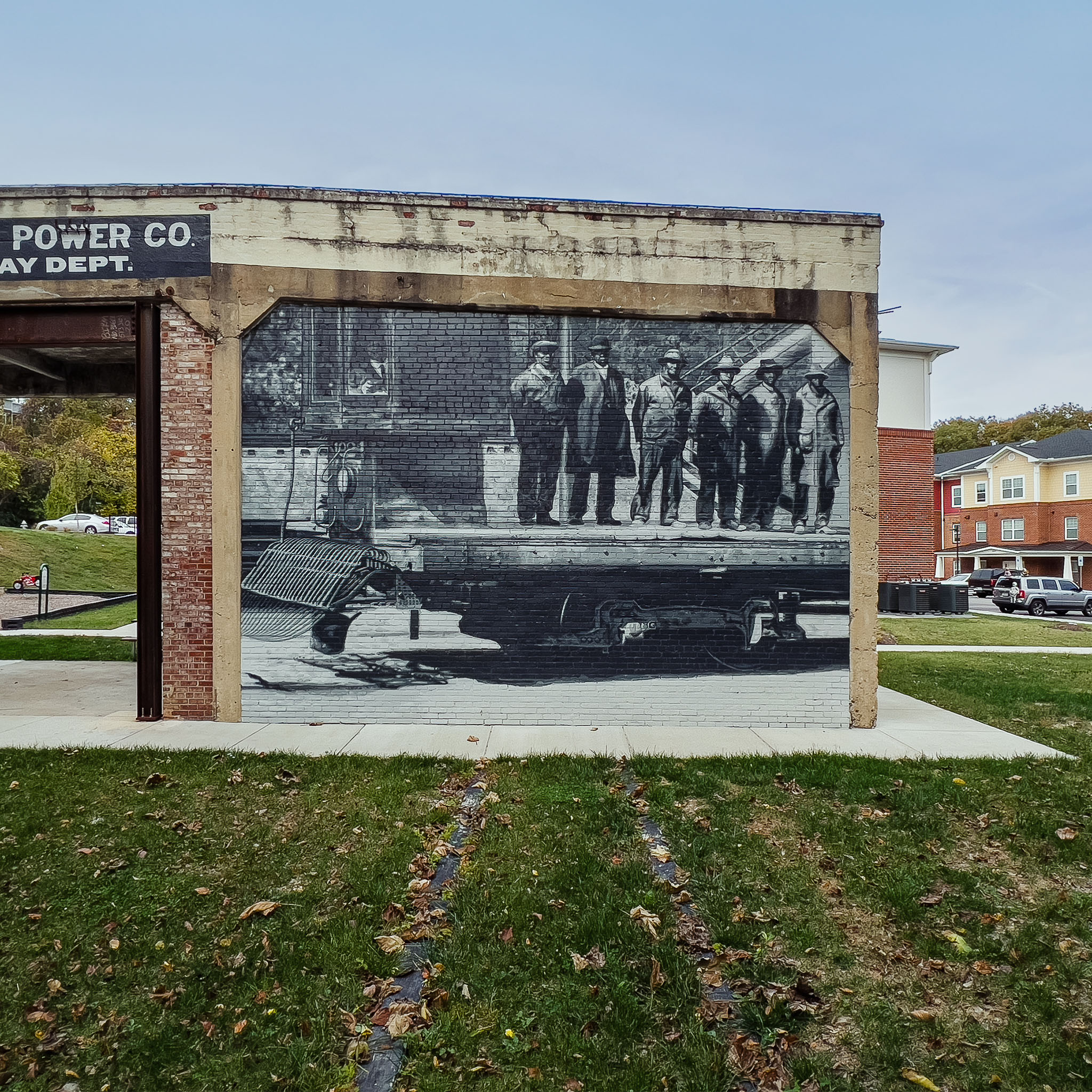
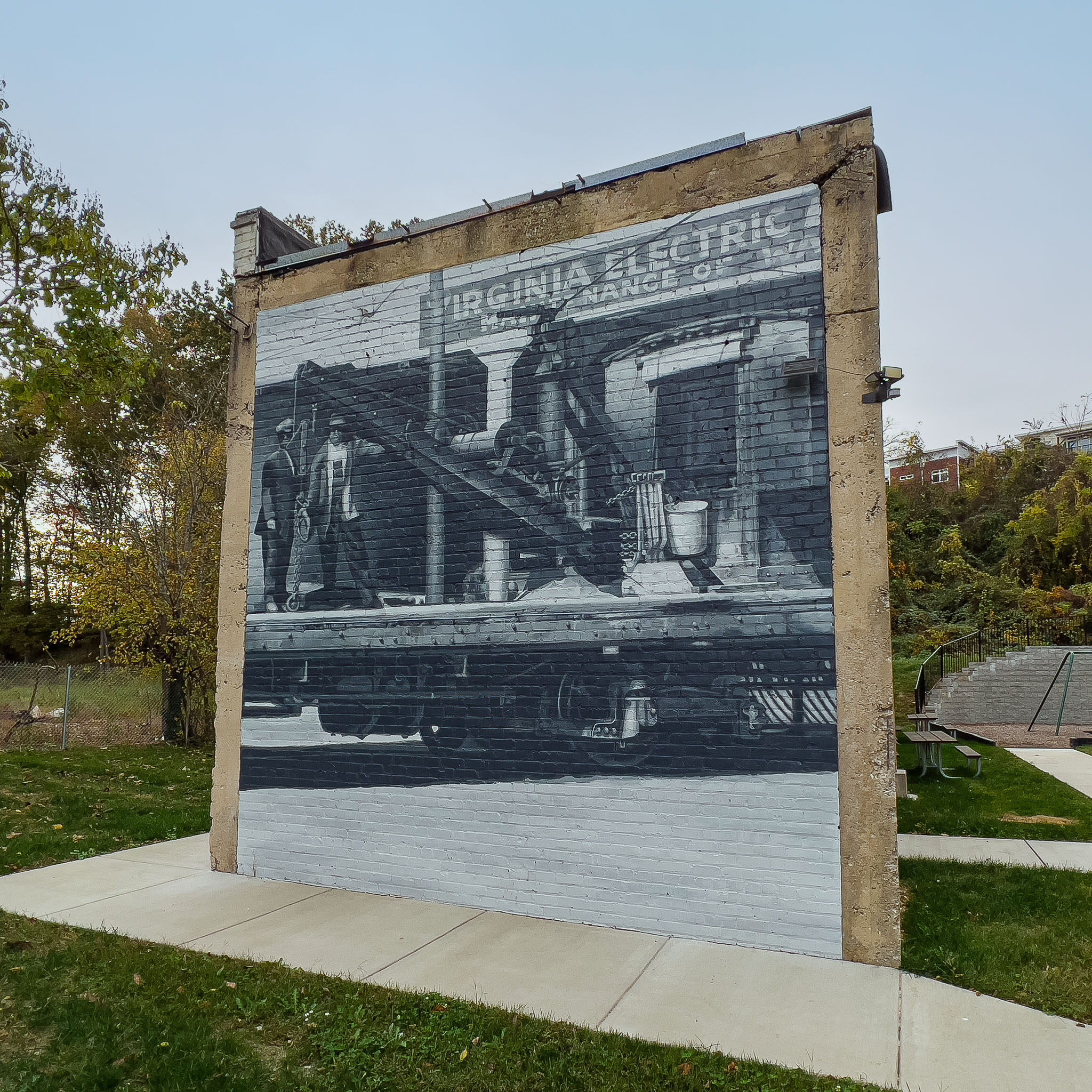
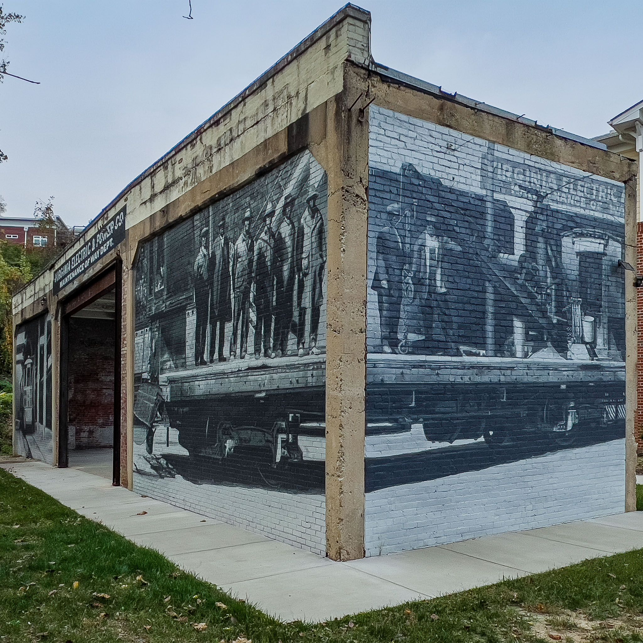
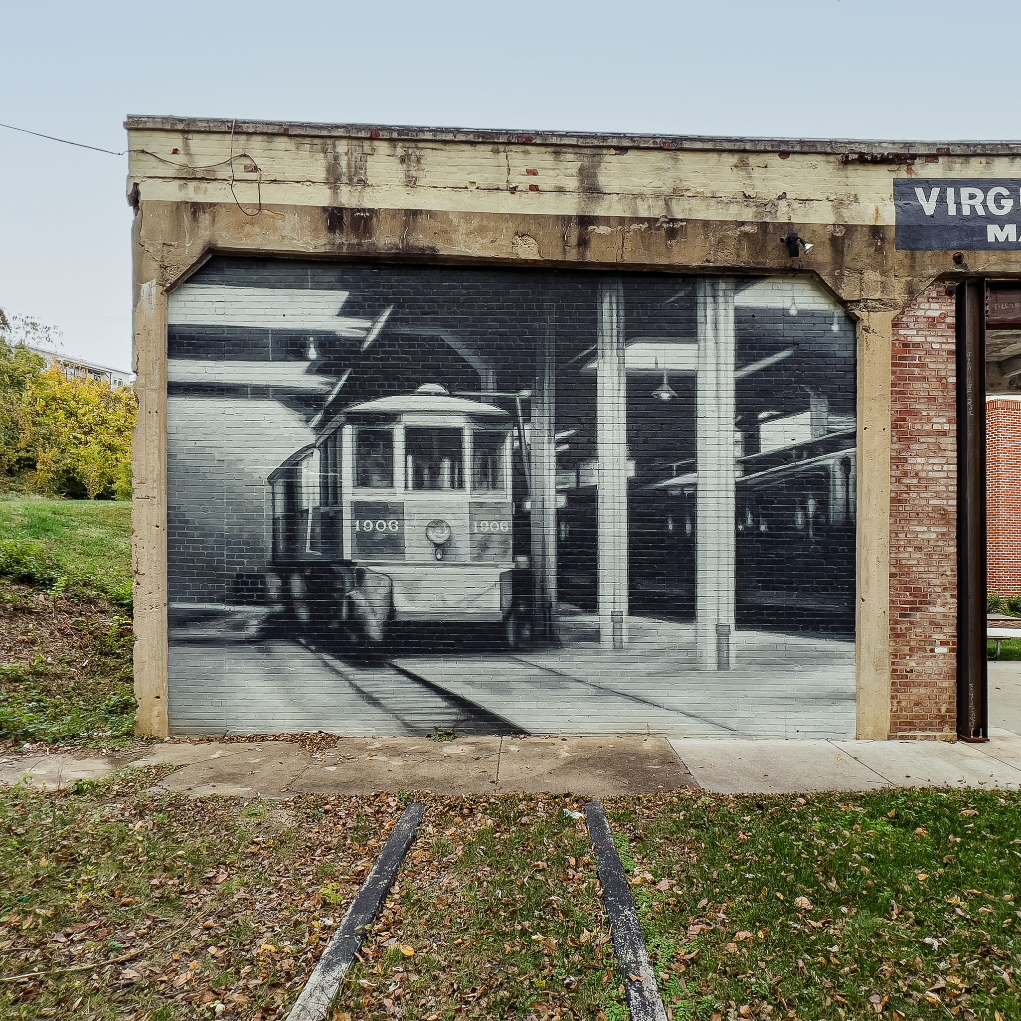
Walls Two and Three: Painting Photographically.
Photography began around 1839. By the time Short Pump’s industrial and agricultural era was fully underway, cameras existed. Photographs were taken. Historical records from that period survive as photographic documents: grainy, imperfect, with the specific visual characteristics of the cameras and chemical processes available at the time.
“Painting Photographically” is a technique developed specifically for this kind of work. It’s not the same as photorealistic painting, and the distinction is intentional and important.
Photorealistic painting makes historical subjects look like high-resolution modern photographs: perfectly sharp, evenly lit, with contemporary visual clarity. The result is technically impressive. It also feels fabricated. Your eye recognizes modern photographic quality applied to a historical subject, and the brain holds it at a slight distance.
Painting Photographically means recreating how cameras from the actual era captured these moments. Period-specific grain structure. The way early lenses couldn’t hold focus evenly across the entire frame, with subjects sharp at center and softer toward the edges. The way early film blew out highlights in ways modern sensors don’t. The sepia undertones of chemical aging. The particular damaged quality of a photograph that has been handled and stored for a century.
When those qualities are present, something different happens in the viewer. The brain recognizes the visual language of the grandparents’ photo album. It triggers trust rather than admiration. You don’t think “that artist is skilled.” You think “this is real. These people were here. This happened.” That shift from art appreciation to historical recognition is the whole point of the technique.
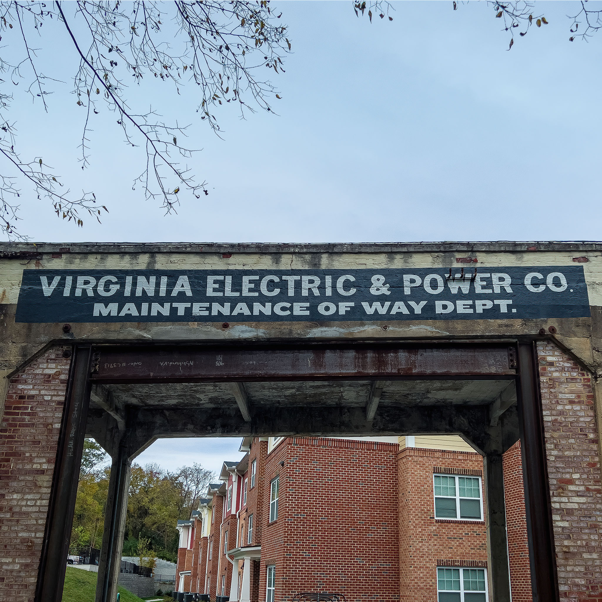
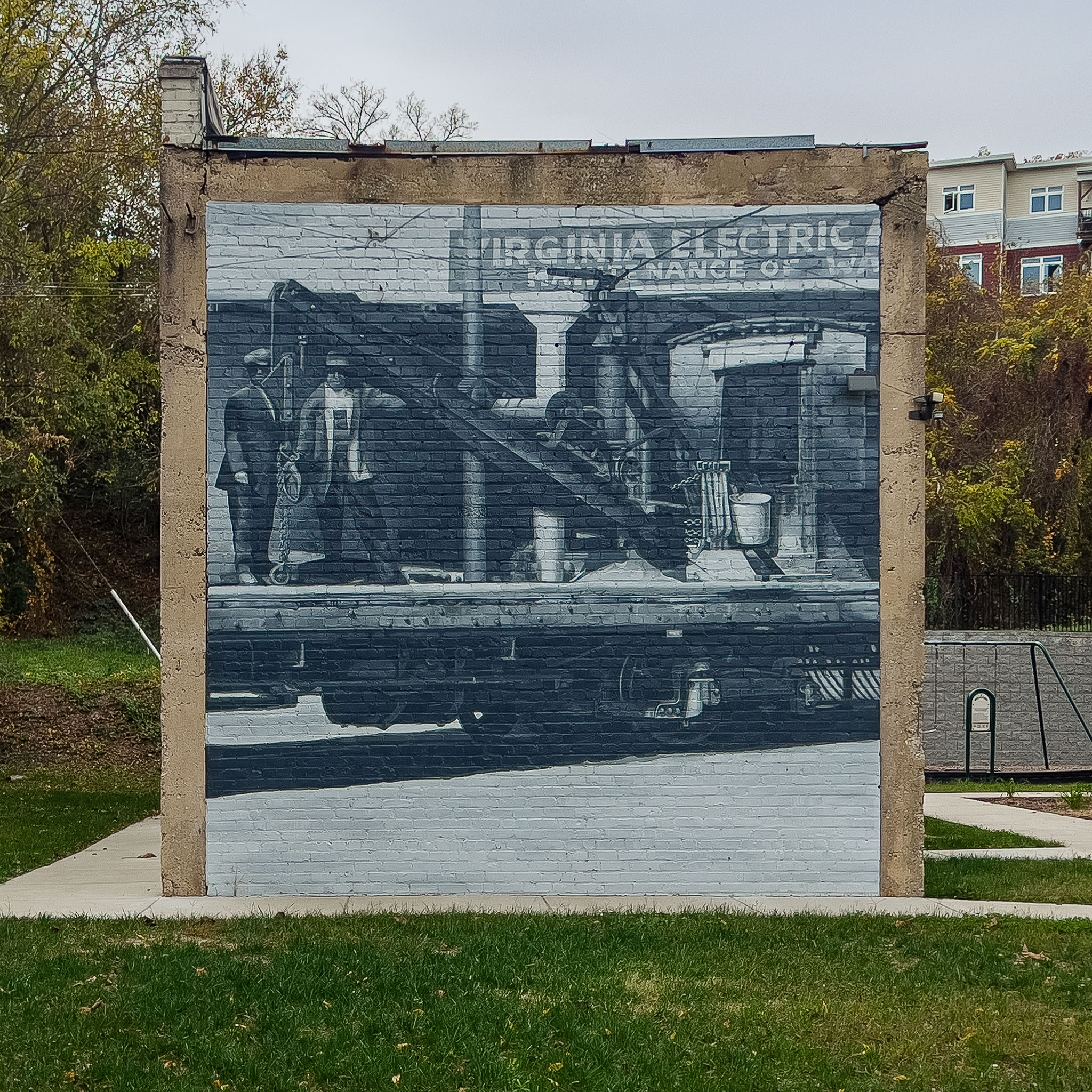
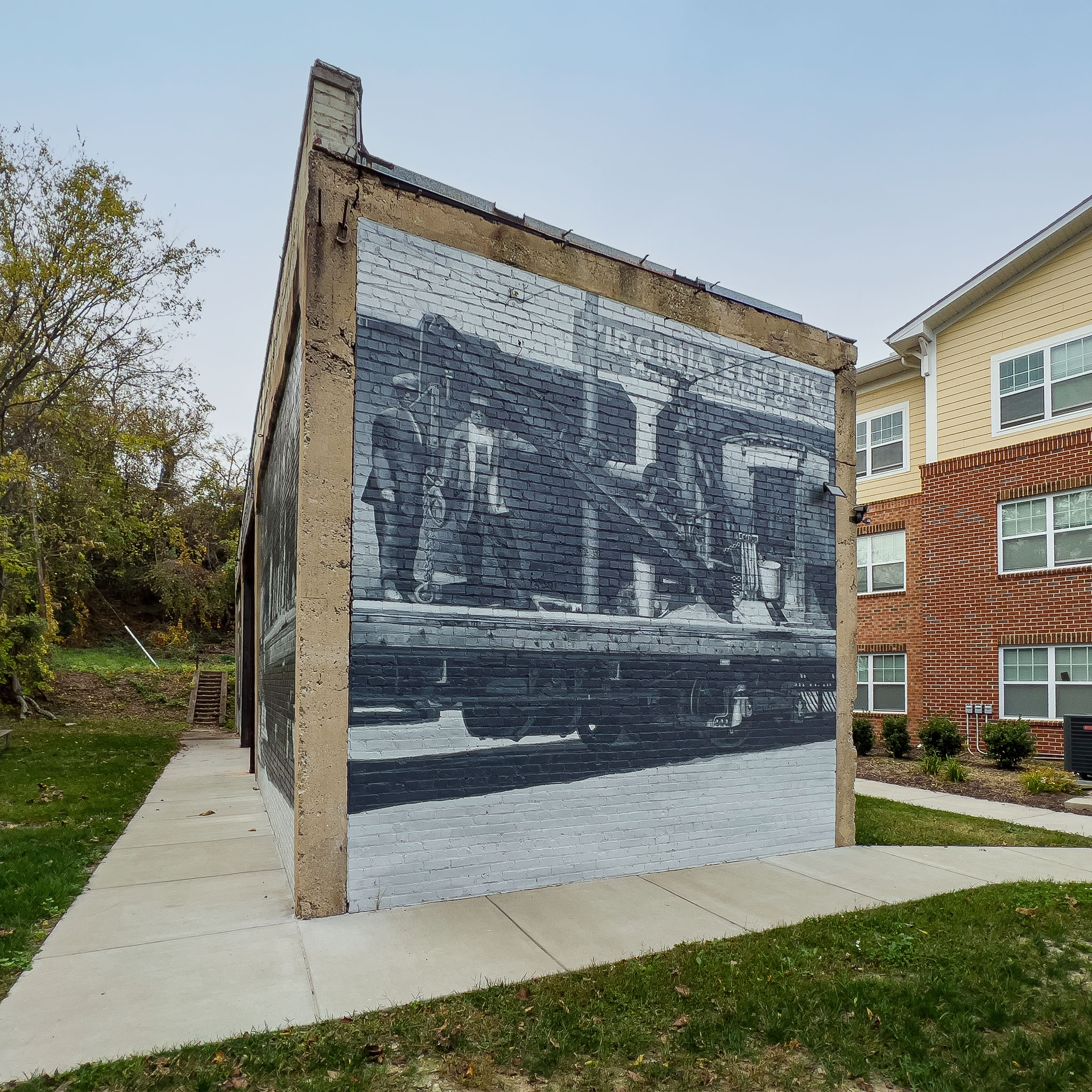
Walls Two and Three, the industrial and agricultural chapter and the education chapter, were both painted photographically. The source material for both chapters existed as actual historical photographs. The finished murals look like those photographs at building scale.
Wall One: The era before cameras.
The Native American chapter presented a different problem. The history it depicts precedes photography by centuries. There are no photographs of Indigenous daily life in this region from the pre-contact period. The document type that actually survives from that era is the hand-drawn illustration: cartographic sketches, colonial expedition drawings, the visual language of mapmakers and early explorers trying to record what they observed. The three-notch trail that became Three Chopt Road appears in those early documents. That’s the tradition Wall One is painted in.
Painting this chapter Photographically would have been wrong. It would have imposed modern documentary conventions on a period that had none. Instead, Wall One is painted to look like the historical illustrations it’s drawn from: hand-rendered line work with the qualities and conventions of period illustration, an aesthetic that matches how that era was actually documented.
This is the same principle as the photographic technique, applied to a different source material. The goal isn’t to achieve a single consistent art style across all three walls. The goal is to use the visual language that belongs to each era’s actual historical documents.

The full wraps: a story that continues around the corner.
All three walls are wrapped. That means the mural imagery doesn’t stop at the front face of each wall. It continues seamlessly around both sides.
This was a design decision rooted in how the site actually works. Visitors don’t stand still in front of the walls. They move. They walk alongside them, around them, past them. The curved geometry of each wall naturally invites movement. A standard flat-face mural would break the experience the moment someone stepped to the side.
The full wrap treats each wall as a three-dimensional historical chapter rather than a framed image. Visitors who walk around the structure continue to read the story, find new details, and engage with content they didn’t see from the front. The walls reward circumnavigation. Each circuit reveals something that wasn’t visible from the path.
The ground: specialized paint most muralists won’t attempt.
The 30-by-10-foot ground map anchors the installation physically and conceptually. Its bold black field carries the historic road network in white hand-drawn lines, property owner names from the original land records, and a marker showing exactly where the visitor is standing within that geography.
The ground map also represents a technical commitment that separates this project from most public murals.
Exterior paints suitable for walls are not the same as paints suitable for ground surfaces under daily foot traffic, weather exposure, UV radiation, and occasional vehicle access. The paint system selected here can handle the full load: it’s used in environments where buses and service vehicles roll over it, bonded chemically to the concrete substrate for maximum adhesion, UV-stabilized to prevent fading, and skid-resistant for pedestrian safety.
Most mural artists don’t use this system because it requires specific surface preparation knowledge, careful application sequencing, and specialized materials that are harder to work with than standard exterior acrylics. The payoff is a ground installation that can be cleaned with solvent-free methods in under five minutes and won’t require re-coating for years.
This isn’t a detail most visitors will ever notice. But it’s the difference between a ground installation that survives and one that deteriorates.
Protection: what the coatings do and why they matter.
All three walls received anti-graffiti and weatherproof topcoats after the mural was complete.
Anti-graffiti protection on a public installation isn’t optional. It’s the difference between a mural that’s maintained for decades and one that’s defaced once and never fully recovered. The system applied here uses a non-sacrificial coating: it allows graffiti to be removed with a solvent wipe without stripping or damaging the artwork beneath. One application protects through multiple removal cycles.
The weatherproof system adds UV resistance to prevent color shift over time. The paint system below it bonds chemically with the concrete substrate rather than sitting on top of it as a film. This means the mural can’t peel the way an acrylic-over-concrete system eventually will. The color is in the wall, not on it.
The system carries a 20-year color warranty. Henrico Parks has allocated $750 per year for inspection and spot maintenance, with the complete material specifications archived so any touch-up needed 20 or 30 years from now can match the original precisely.
The finished work.


What the project delivered.
- Three fully wrapped walls carrying 540 square feet of hand-rendered mural across all faces, built from 50 to 75 archival photographs sourced from primary sources
- Two distinct painting techniques applied to different eras: Painting Photographically on the industrial and education chapters, matching the visual language of surviving photographic documents; period illustration style on the Native American chapter, matching the visual language of the pre-photographic historical record
- A 30-by-10-foot ground map painted in a specialized traffic-rated paint system bonded chemically to the concrete substrate, durable under vehicle traffic and years of weather exposure
- Full surface restoration on all three walls: removal of the prior failed installation, crack repair and patching, quartz-fortified skim coat resurfacing, and alkali-resistant primer system before the first mural paint was applied
- Anti-graffiti and weatherproof topcoats on all three walls, non-sacrificial system with a 20-year color warranty
- A Certificate of Provenance tracing every visual element in the installation back to its documented source in the archival record
The impact.
The safety problem was resolved immediately. Henrico Parks removed the caution fencing within two weeks of completion. Zero climbing incidents since.
In the first 90 days, pedestrian dwell-time along the splash-pad axis increased by 38 percent, measured by the county’s motion sensors. The installation gathered more than 1,400 posts tagged #ShortPumpHistoryWall on social media. The Richmond Times-Dispatch ran a front-page feature. WCVE radio produced a segment on the project.
The county has since earmarked funding for two additional history-based murals along the same parkway, citing this installation as the model. The project designed to answer a safety problem ended up writing the brief for a county-wide program.
Those are numbers. Here’s what the numbers represent.
Every morning, the dog park beside these walls fills with people from across the county. Dog walkers, parents, retirees out before the heat. They pass these walls on the way in and on the way out. Many of them stop. Most had never heard of Virginia Estelle Randolph, the first Jeanes Supervising Industrial Teacher in the country, whose influence shaped the Springfield School depicted on Wall Three. Most didn’t know that Gayton Mines, painted into Wall Two, was one of America’s first commercial coalfields. Most had no idea that the road they drove to get here began as a Native American trail marked by three notches carved into trees centuries before it had a name.
What working with us looks like.
The Short Pump project started with three weeks of archival research before we touched anything. It required understanding not just what history to put on the walls, but what visual language belongs to each era, and why getting that distinction right matters to whether the installation feels true or feels fabricated.
From first conversation to completed mural, this project spanned nearly three years. Henrico County needed time to gather archival images and secure funding. That process took almost two years before installation began. Then the installation itself ran three months, shaped by Virginia summer heat and the preparation work that a project of this scale demands.
For every project we take on, the approach is the same: go to the source first, find what’s actually there, and build the visual language from the documented record rather than from aesthetic preference. That’s what makes a Certificate of Provenance possible, and it’s what makes the work last beyond the initial reaction.
The finished installation is not applied to the park. It belongs to it.
Tell us about your walls.
Start a Conversation